- Store
- >
- Hobby Division
- >
- Metal Detectors
- >
- GEO EXAMINER METAL DETECTOR
GEO EXAMINER METAL DETECTOR
SKU:
GE-1222
$8,000.00
$7,680.00
$7,680.00
Unavailable
per item
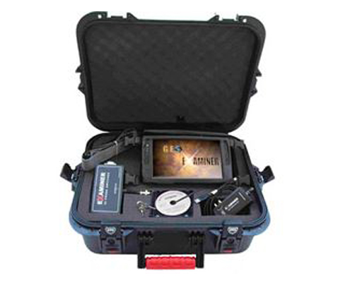
World’s first 3D metal detector fully tablet PC operated
- the Geo Examiner ground radar, combines 3 proven treasure hunting techniques in one:
probes, magnetometer and metal detector !
Where others see a computer, the user has an advanced real time imaging ground radar in disguise !
GEO EXAMINER has 3 integrated systems for the price of one:
• Geophysical locator- for large metal detection and void location with graphical separation
of metal targets from voids and other geological features.
Uses ground transmitting and receiving probes for data collection.
The geophysical system comes in 4 probe as standard or 22 probe as optional
• Magnetometer - a super sensitive 80 cm. gradiometer antenna reveals
soil magnetic field disturbances caused by voids, ferrous metals, foundations, walls
• 3D Metal detector - for selective rejection of non valuable metal targets.
More Details:
Geophysical 22 probes module, 22 probes with their 2 x 17m multi cables, Magnetometer in hard carry case.
No need to transfer the data file to a laptop to see higher resolution images ! you do not pay additional money for extra software just for indicating depth.
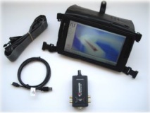
Specifications Display : 9” LED Backlight LCD, 1024 x 600 Resolution Computer : 1.1GHz Processor INTELL Atom Input Device : Resistive touch screen with stylus pen, finger mouse Operating System : Windows 7 Working Memory : 1GB DDR2 Data Memory : 60GB HDD Feedback : voice, visual Dimensions & Weight : 270mm x 145mm x 20mm / 900kg (with Battery) Accessories : AC/DC adapter, Power Cord, Protective bag Safety Certification : CE Battery : Removable standard battery supports up to 3 hours, ( option for external battery for up to 15 hours ) Charging Time (Battery fully discharged) : ca. 1 Hours Leather carry bag and neck straps
3 integrated systems Geophysical. 4 or 22 probe resistivity measurement. Manual ground cancelation control to work at all soil types Gradiometer. 1 m. antenna. Automatic ground cancel Metal Detector with discrimination. Manual ground cancel control Other optional antenna systems are under development! Frequency range Geophysical locator : 137 Hz Magnetometer : +/- 50,000 nT Metal Detector : 25 KHz Computer controlled data collection - Automatic Mode: Recording and Readings are captured automatically at intervals selectable from 1/sec to 100/sec - Manual Mode: Manual capture. Real time data graphics for both modes. Data Points 10.000 scans per survey, ability to store unlimited data files on hard disk. Data point density Dependent on step length, distance between measured profiles and system used : from 5 cm to 10 m. Resolution 10 Bit / 5V. Ambient temperature -20 to 55 C. Data processing On site real time 2D and 3D target presentations, interpretation, modeling, replay, exporting to bmp, jpg, metafile, png and data file formats, printing. Standard equipment - GEO EXAMINER Computer, -Interface, - Geophysical locator with 4 probes / cables, in watertight case


